
Step beyond the postcard overlooks and walk the edges where parks truly breathe. Park Perimeters: Uncharted Hiking Grounds invites you to explore boundary trails, forgotten service roads, and fence-line footpaths that reveal hidden stories, rich ecology, and quiet solitude. Dive in, share your finds, and subscribe to map the margins together.
The Allure of the Edge
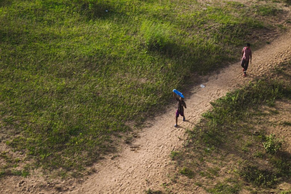
Park perimeters often hum softer than center trails, absorbing wind, birdsong, and distant city echoes like a living amphitheater. Walk a boundary at dawn, and you’ll hear subtle rhythms—gate hinges creaking, owls yielding to thrushes—inviting mindfulness. Tell us about your quietest perimeter moment in the comments.
Mapping the Margins
Finding the Legal Lines
Combine official park boundary maps, county GIS parcels, and land trust overlays to understand where you can walk. Look for public easements and right-of-way corridors connecting gate to gate. Ask rangers when uncertain, and drop your trusted mapping sources below to help the community plan responsibly.
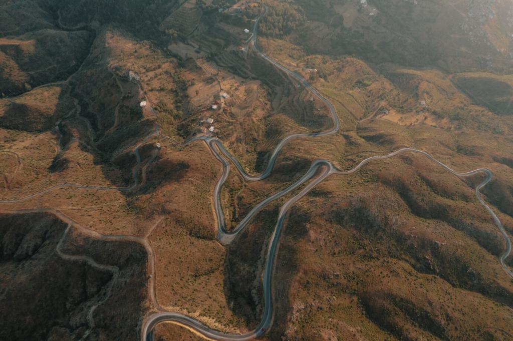
Reading Terrain Like a Local
Contour lines can reveal forgotten service roads hugging a park’s edge, while vegetation breaks often trace fence lines or utility easements. Scan satellite imagery for linear clearings and subtle track scars. Have a favorite mapping trick for spotting boundary paths? Comment your method so others can learn.
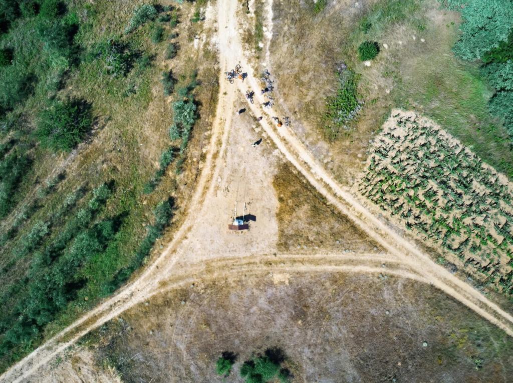
Timing, Light, and Exit Strategy
Edges can loop near multiple trailheads, making timing and bailout planning straightforward. Track daylight, gate hours, and bus routes touching park borders. A golden-hour perimeter often glows with side-lit grasses. Share your best time-of-day for perimeter hikes and subscribe for seasonal timing guides.
Navigation You Can Trust
Carry an offline map app, a small compass, and a lightweight power bank. Boundary paths sometimes fade into utility corridors or thickets. Mark gates, culverts, and survey markers as waypoints. What’s in your navigation kit for uncertain edges? Drop your essentials so newcomers can pack smarter.
Clothing for Brush and Breeze
Edges host thorns, ticks, and sudden wind channels. Wear durable pants, layered tops, and a brimmed hat. Gaiters help when grass is knee-high. Choose quiet fabrics that don’t snag. Tell us your go-to perimeter outfit, and subscribe to our quarterly field-tested gear list focused on boundary travel.
Small Tools, Big Payoff
A compact first-aid kit, tick remover, and micro-fiber cloth for wet gate rails go a long way. Add a tiny flashlight for culvert underpasses, and biodegradable flagging tape for temporary markers you’ll remove on exit. Share your lightweight add-ons that make perimeters safer and friendlier.
Ecology at the Boundary
01
The Edge Effect Explained
Perimeters often host increased species richness as forest meets meadow or wetland meets upland. But edges also favor certain generalists and can stress interior specialists. Watch for transitions in birdsong and undergrowth. Observed a surprising species at a park boundary? Share your notes to inform fellow hikers.
02
Invasives and Corridors
Roads and fence lines can act as conduits for invasive plants. Spot knotweed, barberry, or garlic mustard hugging a path? Note coordinates and alert managers if invited. Your observations matter. Join our newsletter for seasonal invasive ID cards tailored to common perimeter ecosystems near you.
03
Seasonal Shifts on the Edge
Spring light pours through boundary canopies before leaves close, revealing ephemerals. Autumn winds sweep leaves along fence feet, exposing animal tracks. Winter highlights utility clearings you’d miss in summer. Comment your favorite season for perimeter hikes, and tag us in your edge-season photos.
Ethics, Access, and Safety
Stay on public land and heed closure signs, especially near private interfaces or restoration areas. If a boundary turns ambiguous, backtrack and seek official routes. Tell us how you handle uncertainty, and consider joining our community pledge to model ethical perimeter hiking where you live.
Ethics, Access, and Safety
Rangers know which service roads are walkable and which are strictly operational. A friendly check-in can unlock safer, richer routes. Share a positive ranger interaction in the comments, and subscribe for our monthly Q&A where land managers answer your perimeter questions directly.
Stories from the Fence Line
One chilly morning, a service gate groaned open with the first ranger drive-through, and a red fox slipped along the fence like a shadow. I paused, breath fogging, letting it pass. Share your edge wildlife encounters and help us map quiet hours when animals feel safest at the boundary.
Stories from the Fence Line
Near a blackberry hedge, a brass survey cap winked under leaf litter, stamped with initials and a year almost forgotten. That small artifact reframed the trail as a ledger of stewardship. Found something similar? Post your photo and location notes so others can appreciate the boundary’s living archive.
Your Perimeter Project
This month, trace a complete park perimeter or a meaningful segment. Mark gates, culverts, overlook spurs, and habitat shifts. Upload your GPX with notes, and we’ll feature standout contributions. Join our mailing list for challenge prompts and interviews with mappers pushing boundary exploration forward.